Report to/Rapport au :
Comité des transports
12 August 2011 / le 12 aoùt 2011
Submitted by/Soumis par : Nancy Schepers,
Deputy City Manager, Directrice municipale adjointe, Infrastructure
Services and Community Sustainability, Services
d'infrastructure et Viabilité des collectivités
Contact/Personne ressource: Vivi Chi,
Manager/Gestionnaire, Transportation Planning/Planification des transports,
Planning and Growth Management/Urbanisme et Gestion
de la croissance
(613) 580-2424 x
21877, Vivi.Chi@ottawa.ca
|
SUBJECT: |
Bank Street Widening (Leitrm Road
to Rideau road) ENVIRONMENTAL ASSESSMENT Study – Statement OF WORK |
|
OBJET : |
Étude d’évaluation environnementale sur
l’Élargissement de la rue Bank (entre les chemins Leitrim et Rideau) – Énoncé
des travaux |
REPORT RECOMMENDATION
That the Transportation Committee approve the Statement of Work for the
proposed Bank Street widening from Leitrim Road to Rideau Road Environmental
Assessment Study, as detailed in Document 1.
RECOMMANDATION DU
RAPPORT
Que le Comité des
transports approuve l’Énoncé des travaux de l’Étude d’évaluation environnementale proposée pour le projet d’élargissement de
la rue Bank entre les chemins Leitrim et Rideau, comme le décrit le document 1.
BACKGROUND
Bank Street is a major north-south arterial road in Ottawa. Beginning at Wellington Street in the downtown area, Bank Street runs south through the neighbourhoods of Centretown, the Glebe, Old Ottawa South, Alta Vista, Hunt Club, Blossom Park, and Leitrim, which is at the City’s urban boundary. Bank Street then continues south through the rural villages of South Gloucester, Greely, Metcalfe, Spring Hill, and Vernon, before exiting the City limits. From Wellington Street to Leitrim Road, Bank Street is a four lane urban arterial roadway narrowing to a two lane rural roadway just south of Leitrim Road, where a growing community resides.
In response to increased pressures for development, Council approved the Leitrim Community Design Plan (CDP) in July 2005. The Leitrim community lies south of Leitrim Road, bordered by Albion Road to the west and Bank Street to the east. Largely undeveloped at the time, the CDP provides a detailed development concept plan, guides future development, and identifies a recommended road network within the Leitrim community.
Rapid growth in this area has increased traffic volumes on Bank Street leading to congestion during the peak periods. The City has recently approved the “Findlay Creek Stage 2” development application, consisting of 703 residential units. A condition of development is to extend Findlay Creek Drive to Albion Road since Bank Street is currently the only access to the Leitrim community. Completion of Stages 1 and 2 of the Findlay Creek development is anticipated in 2012/13 and will total approximately 1420 dwelling units. The traffic impact study undertaken for Stage 2 development indicates that traffic volumes to accommodate this growth on Bank Street will exceed capacity by 2014 and widening of Bank Street will be required.
DISCUSSION
The City’s Transportation Master Plan (TMP) identifies the widening of Bank Street to four lanes from Leitrim Road to the urban boundary in Phase 2 (2016-2022) and further south to Mitch Owens Drive in Phase 3 (2023-2031). Under provincial legislation, an Environmental Assessment (EA) study is required prior to widening of Bank Street. This report provides the terms of reference for the EA study and outlines the Statement of Work (SoW), described in Document 1.
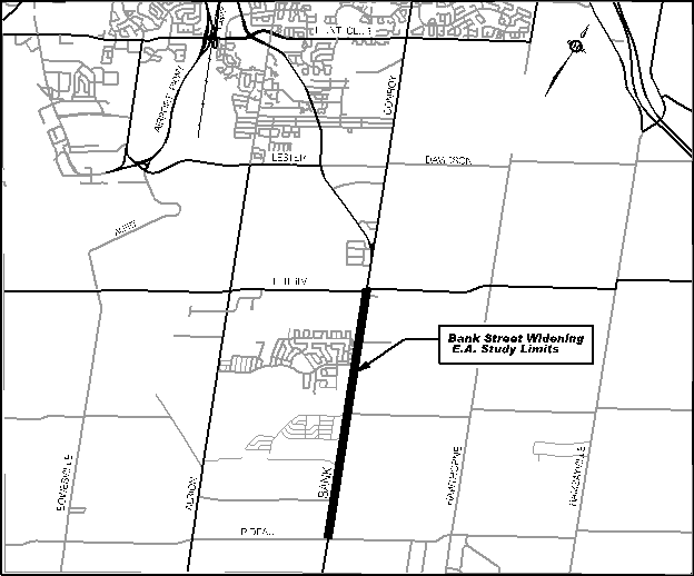
The study limits, shown in Figure 1, will extend from Leitrim Road to Rideau Road, beyond the TMP’s Phase 2 limit of the Urban Boundary. This is in response to a Council approved motion for the planned rezoning of a pilot project for the Rideau Carleton Raceway (RCR) to assess the transportation infrastructure needs in this area. While the transportation infrastructure needs of the RCR will be examined as part of the next TMP update from a network perspective, this EA study will take the development of the RCR into consideration as a source of demand impact on Bank Street.
In addition to the RCR rezoning, the Central Canada Exhibition is proposing to relocate the SuperEX in 2012 permanently to a site in the vicinity of Rideau Road and Albion Road and the transportation impact on the road network also needs to be considered.
Figure 1: Bank Street Widening
EA Study Limits
Key considerations for this EA study include the following:
· Detailed evaluation of future transportation demand for the City’s north-south direction of travel and public areas of interest;
· Cycling and pedestrian needs in the arterial roadway corridor;
· Full evaluation of any potential impacts on wetlands and other natural environment areas;
· Preserving the rural character of rural areas; and
· Effects on existing community.
ENVIRONMENTAL IMPLICATIONS
The study will examine and evaluate the project’s effects on social, cultural, physical, and natural environments within the study area. Appropriate mitigation measures will be developed and post mitigation environmental impacts will also be determined.
RURAL IMPLICATIONS
The study area lies within the City’s urban area to the west and rural area to the east of Bank Street. Potential impacts on the rural character, rural residents, and any active farming operations will be incorporated in the study. Traffic demand originating from existing and future residents of the rural areas will also be incorporated into the study process.
CONSULTATION
Consultation with stakeholders, public agents, and individuals will be an integral component of the EA study. The consultation process will include meetings with key stakeholders through the Agency Consultation Group, Public Consultation Group, and Business Consultation Group. Consultation with the general public will occur principally through open houses and also through the project web page, e-mail, and additional meetings as required.
COMMENTS BY THE WARD COUNCILLOR(S)
Councillor Deans provided the following comments:
1. Please include the Rideau Carleton Raceway and Slots as a member of the Business Consultation group and consider the impact of the Rideau Carleton Raceway and Slots operation on Bank Street.
2. Please identify the need for future studies to address downstream effects on existing roadways such as Conroy, Kemp, Orville Kemp, Leitrim, Lester, Bank and Walkley Roads.
3. Please explore the possibility of including HOV lanes and, or dedicated bus lanes as part of the E.A. analysis.
Councillor Thompson indicated
concurrence with this report.
Councillor Desroches indicated he supports planned upgrades to Bank Street given the growth in the Findlay Creek and Leitrim area. His comments are as follows:
This important infrastructure work will support the City’s pedestrian, transit and cycling objectives. There is growing demand for improved cycling facilities in this area, especially for employees of CFB Leitrim. The planned sidewalks will also improve pedestrian access and improve connectivity to the City of Ottawa recreational facilities at the Fred Barrett arena. Bank Street is a gateway to the Nation’s capital and should have appropriate urban infrastructure. Transit in the area will be enhanced by improving the reliability of the service along Bank Street. The study should also include upgrades to the Leitrim Road approaches to Bank Street. This south area road work is important given the growth in the area, access to the Ottawa airport, the new trade and conference centre and the Rideau Carleton Raceway.
LEGAL IMPLICATIONS:
There are no legal
implications associated with this report.
RISK MANAGEMENT IMPLICATIONS:
There are no risk management implications associated with this report.
CITY STRATEGIC PLAN
The recommendation contained herein aims to support the following Strategic Directions adopted by Council:
Transportation
Objective 1: Improve the City’s transportation network to afford ease of mobility, keep pace with growth, reduce congestion and work towards modal split targets.
Planning and Growth Management
Objective 3: Ensure that the City infrastructure required for new growth is built or improved as needed to serve growth.
FINANCIAL IMPLICATIONS
Funding for this study is available under capital account # 905396 – 2011 Environmental Assessment Studies Arterial Roads.
SUPPORTING DOCUMENTATION
Document 1 Bank Street Widening from Leitrim Road to Rideau Road EA Study – Statement of Work.
DISPOSITION
Following Committee approval of the attached Statement of Work, the selection of consultants will commence. A call for proposal will be undertaken under the direction of Supply Management Branch.
INTRODUCTION
The City of Ottawa is the proponent of a Class Environmental
Assessment (EA) Schedule C to study the proposed widening of Bank Street from Leitrim
Road to Rideau Road. This Statement of
Work describes the City’s intentions with respect to the methodology, public
consultation and deliverables for this study.
PLANNING CONTEXT
In response to increased pressures for development, Council approved the Leitrim Community Design Plan (CDP) in July 2005. The Leitrim community lies south of Leitrim Road, bordered by Albion Road to the west and Bank Street to the east. Largely undeveloped at the time, the CDP provides a detailed development concept plan, guides future development, and identifies a recommended road network within the Leitrim community.
Rapid growth in this area has increased traffic volumes on Bank Street leading to congestion during the peak periods. The City has recently approved the “Findlay Creek Stage 2” development application, consisting of 703 residential units. A condition of development is to extend Findlay Creek Drive to Albion Road since Bank Street is currently the only access to the Leitrim community. Completion of Stages 1 and 2 of the Findlay Creek development is anticipated in 2012/13 and will total approximately 1420 dwelling units. The traffic impact study undertaken for Stage 2 development indicates that traffic volumes to accommodate this growth on Bank Street will exceed capacity by 2014 and widening of Bank Street will be required.
The City’s Transportation Master Plan (TMP) identifies the widening of Bank Street to four lanes from Leitrim Road to the urban boundary in Phase 2 (2016-2022) and further south to Mitch Owens Drive in Phase 3 (2023-2031). Under provincial legislation, an Environmental Assessment (EA) study is required prior to widening of Bank Street.
The study limits, shown in Figure 1, will extend from Leitrim Road to Rideau Road, beyond the TMP’s Phase 2 limit of the Urban Boundary. This is in response to a Council approved motion for the planned rezoning of a pilot project for the Rideau Carleton Raceway (RCR) to assess the transportation infrastructure needs in this area. While the transportation infrastructure needs of the RCR will be examined as part of the next TMP update from a network perspective, this EA study will take the development of the RCR into consideration as a source of demand impact on Bank Street.
In addition to the RCR rezoning, the Central Canada Exhibition is proposing to relocate the SuperEX in 2012 permanently to a site in the vicinity of Rideau Road and Albion Road and the transportation impact on the road network also needs to be considered.
Key considerations for this EA study include the following:
· Detailed evaluation of future transportation demand for the City’s north-south direction of travel and public areas of interest.
· Cycling and pedestrian needs in the arterial roadway corridor.
· Full evaluation of any potential impacts on wetlands and other natural environment areas.
· Preserving the rural character in the rural areas.
· Effects on existing community.
PROJECT SCOPE, TASKS, AND DELIVERABLES
1. General
The study will be consistent with the approach and requirements set out in the Provincial Environmental Assessment Act. Federal EA requirements may also be required if federal lands, permits, and funding are impacted. All relevant environmental inventories and analysis undertaken for this assignment will be of sufficient scope to satisfy both Federal and Provincial EA requirements.
1.1 Study Area
The primary study area, shown in Figure 1, includes the Bank
Street Road corridor from Leitrim Road to Rideau Road. The study area may be adjusted as necessary
in order to comprehensively identify the influences on, and the effects of the
undertaking as options are developed.
Figure
1 - Proposed Study Area
1.2 Timing
The study is expected to be completed within approximately 18
months.
1.3 Co-ordination
with Concurrent Studies
The EA Study process will take into
consideration any information including analysis and preliminary findings of
concurrent on-going transportation, development and infrastructure projects
that could influence the direction and/or conclusions of the Study. These
projects include:
- Current development applications
and associated studies (i.e. transportation impact studies).
1.4 Background
Material
Relevant background material will be
collected and reviewed. This includes:
- City
policies/guidelines/practices;
- Travel surveys and traffic counts
including travel demand forecasts and origin/destination data;
- Population, employment and
development projections;
- Current and past development
applications and associated studies (e.g. traffic and noise);
- Property ownership (and tenants),
easements and rights-of-way information;
- Natural environment studies, such
as the Urban Natural Areas Environmental Evaluation Study (2005);
- Relevant economic development
studies;
- Relevant water, wastewater and
storm water management studies;
- Relevant stream crossing
information (fisheries, water quality, etc.);
- Regional Road Corridor Design
Guidelines;
- City Pedestrian and Cycling plans;
and
- Current and planned transit
priority opportunities.
1.5 Summary
of Deliverables
The deliverables for the study include:
- Study Design and Schedule
Document;
- Presentation Materials for
Consultation Group meetings and Public Open Houses;
- Public Open House Summary Report –
one for each of three Public Open Houses;
- Project Update Newsletter –
minimum of three;
- Information (text and graphics)
for Study Web Page;
- Draft and final Environmental
Study Report (ESR);
- Project Recommended Plan
incorporating functional design drawings of the preferred design, and
other information as detailed elsewhere in this document;
- Approvals in principle for storm
water management facilities, grade separations, etc; and
- Project Cost Estimate Report
identifying the project baseline budget in Work Breakdown Structure (WBS)
format.
2. Study
Design
A Study Design will be developed to ensure
that all aspects of the EA will be addressed.
Part of this task will be to liaise with the Provincial and Federal
authorities responsible for EA reviews to obtain their input on what EA
requirements must be met (specific to this project). The Study Design will:
- Confirm the study area;
- Identify the various disciplines
required to undertake the EA with expertise in areas such as:
o
Transportation planning and design;
o
Urban planning;
o
Natural environment;
o
Storm Water Management/Hydrology;
o
Geotechnical;
o
Social environment;
o
Municipal/Utilities;
o
Noise;
o
Vibration;
o
Structural;
o
Air quality;
o
Archaeology;
o
Heritage; and
o
Landscape architecture.
- Describe the major tasks of the
EA, including a plan for development of alternatives as well as a process
for the evaluation of the alternatives;
- Include a detailed public
consultation program identifying the roles and responsibilities of the
Study Consultation Groups, as well as timelines and communication plans
for the Public Open Houses;
- Highlight major milestones and decision
points; and
- Undergo public consultation with
the Consultation Groups and Public Open Houses.
2.1 Identify
a List of Stakeholders
This study will involve a number of
stakeholders, including community groups, property owners, businesses, approval
agencies and special interest groups.
Early in the study process, stakeholders will be identified. This will be accomplished through various
forms of consultation, including liaison with Ward Councillors.
2.2 Consultation
Program
This study will examine a wide range of
technical, social and environmental issues and will incorporate a broad number
of community and business interests. The success of this effort is contingent
on an effective, comprehensive and timely consultation program.
The consultation process will include
meetings with key stakeholders as well as an Agency Consultation Group (ACG), a
Public Consultation Group (PCG), and a Business Consultation Group (BCG). The membership, roles and responsibilities of
these groups will be refined through the Study Design, and include a general
invitation to all City Advisory Committees.
Consultation with the general public
will occur principally through Public Open Houses, but also through the project
Web page and by e-mail. Additional
meetings with specific agencies, groups or individuals will be held as required
in order to address any particular issues as they may arise.
3. Environmental
Assessment
The undertaking of the Environmental
Assessment comprises the following tasks outlined below.
3.1 Project
Need
The Class EA work begins with the review of the need and justification for the proposed widening of Bank Street from Leitrim Road to Rideau Road. Although this proposed widening has been identified in the TMP, the need for additional arterial capacity and an examination of need and assumptions is required under the Provincial Environmental Assessment Act. This exercise will be carried out by forecasting travel demand for the south end of the City and determining both existing and future needs for a facility with respect to the impact on north-south travel demand/distribution, economic benefits and links to major employment destinations. In addition, the study will identify current and projected transportation problems and opportunities within the study area.
3.2 Existing
Conditions
An inventory of the social, economic
(agricultural, employment, retail etc.), physical and natural environments
within the study area will be compiled. The inventory will consider all
available background material and where necessary, supplement this information
through on-site surveys and/or detailed studies. The inventory must be of
sufficient detail to enable the analysis and evaluation of alternative
transportation solutions, designs and mitigating measures.
In general, the inventory will identify
and describe those aspects of the environment that could potentially affect, or
be affected by the undertaking. Some of
the specific aspects of the environment associated with this project include:
- Adjacent private property and
neighbouring communities;
- Effects on green spaces and
natural areas
- Current and future cycling and
recreational pathway corridors/routes;
- Potential influence of the project
from/on development patterns in the southern suburban areas and villages;
- Current storm water drainage
patterns
- Subsurface (geotechnical)
conditions
- Heritage and archaeological
conditions
- Utilities including water,
sanitary, hydro, gas, cable, phone, fibre optic, etc; and
- Noise and vibration.
The existing conditions must be
completed for the entire study area so that as alternative solutions and
designs are developed and analyzed, the cumulative effects can be examined. It must also be broad enough to fulfill both
Provincial and Federal EA requirements.
3.3 Alternative
Solutions
The Study will identify and examine all
reasonable alternatives to the widening of Bank Street from Leitrim Road to
Rideau Road.
The key components of this stage
include:
- Identify alternative solutions to
address transportation problems including:
o
Do nothing;
o
Expand and enhance public transit
service (including Park and Ride Facilities) to/from the south suburban areas
and rural villages;
o
Expand and enhance cycling routes;
o
Implement transportation demand
management (TDM) measures to reduce travel demand; and
o
Expand other arterial roadways in the north-south
direction;
- Develop evaluation criteria and
indicators to assess the impacts (with consideration to possible
mitigation measures) on the environment by the various solutions; and
- Analyze and evaluate the
alternative solutions and select the preferred solution(s).
The different alternative solutions and
designs will be developed with input from the Consultation Groups and will be
presented to the public for comments at several Public Open Houses throughout
the study.
The travel-forecasting component
included in this stage of the EA must:
- Identify the needs for all modes
of transportation including walking, cycling, transit, auto and truck;
- Incorporate the principles (e.g.
mode share targets etc.) of the current OP and TMP in balancing demand to
capacity while promoting the desire to increase transit use, and
appropriate land uses;
- Provide supporting analysis and
recommendations for the staging of construction and alternative or
supporting infrastructure.
3.4 Design
Alternatives
The study will identify and evaluate
various design alternatives for the selected solution. Alignment and cross-section design
alternatives will be identified based on consideration of constraints within
the study area, input from the public and approval agencies, landowners, as
well as City guidelines/standards/practices.
All proposed designs will include any required modifications on
connecting roadways (public or private).
3.5 Evaluation
Criteria and Evaluation Process
A comprehensive evaluation criteria and
methodology will be developed to evaluate the various alternative designs. The evaluation process will be clearly
described and documented.
3.6 Impact
Assessment
The effects of each alternative design
on the environment will be thoroughly evaluated. Mitigation measures and associated
implications (e.g. cost of mitigation etc.) are to be identified and considered
in the evaluation process. The study
must clearly identify the initial impacts of each alternative as well as the
net post-mitigation effect using quantifiable indicators and measures wherever
possible.
Effects on traffic operations will be
evaluated in accordance with current City guidelines and practices. To ensure
that all impacts are appropriately evaluated, detailed studies will be required
for certain issues such as:
- Air quality;
- Archaeology and heritage;
- Impact on existing homes;
- Noise/Vibration;
- Roadway drainage and storm water
management;
- Subsurface conditions,
geotechnical and utilities; and
- Vegetation/terrestrial habitat
and aquatic habitat.
3.7 Costing
Developing an accurate project baseline
budget is an essential component of this study and it will contribute to the
City’s short and long range capital budget forecasting, priority setting, and
development charges strategy. The
project budget will also form the basis for funding discussions with senior
levels of government, where appropriate.
The baseline budget will be developed using a Work Breakdown Structure
(WBS) format in current dollars, and include contingency allowances.
Project costing is a fundamental
criterion in the evaluation of alternatives and will be a key consideration in
the analysis of staging considerations and to establish implementation
strategies.
3.8 Recommended Plan
Following the evaluation of
alternatives and determining all necessary mitigation measures to minimize any
adverse impacts of the project, a recommended plan will be developed. This will include:
- A detailed written description of
the undertaking including the design parameters;
- Functional design drawings (1:500
scale, plan and profile) for the preferred alignment with a geo-referenced
horizontal alignment, vertical profile, grading, drainage and property
envelope;
- Roadway cross-section drawings for
typical sections as well as at critical areas;
- Mitigation measures to reduce the
environmental impacts of the project;
- Landscape design plan;
- Property requirements plan;
- Storm water management and roadway
drainage requirements, as well as other infrastructure requirements;
- Infrastructure
implementation/staging plan (e.g. water mains, sewers etc.);
- Implementation (phasing) plan and
detour plans during construction;
- Cost.
The recommended plan will clearly
identify and set out the requirements and timing for all subsequent approvals
required to proceed with the construction phase of the project. The recommended plan will be presented to
Transportation Committee and Council for approval.
3.9 Environmental
Study Report
An Environmental Study Report (ESR)
will be prepared to document the entire study process including the approved
design, mitigation measures, and consultation efforts. The ESR will be placed on public record for a
minimum 30-day review period as per the Environmental Assessment Act.
4. Consultation
Consultation with public agencies,
private groups, City Advisory Committees and individuals is an integral
component of this Study. The
consultation process will include meetings with key stakeholders through an Agency
Consultation Group (ACG), a Public Consultation Group (PCG), a Business
Consultation Group (BCG), and the general public through Public Open
Houses. A minimum of three meetings with
each Consultation Group will be held during the course of the study. Representation on the ACG, PCG, and BCG, will
be confirmed during the development of the Study Design and in consultation
with Ward Councillors.
4.1 Agency
Consultation Group
An Agency Consultation Group (ACG) will
be formed to provide input on planning, engineering and environmental issues
and will provide general guidance to the Study Team. ACG members will include experts in their
related fields from government agencies and approval bodies including, but not
limited to:
- Ministry of Transportation of
Ontario
- Rideau Valley Conservation
Authority
- National Capital Commission
- Transport Action Canada
- Public Works Department
- Infrastructure Services Department
- Planning and Growth Management
Department
- Transit Services Department
- Emergency and Protective Services
Department
- Realty Services Branch; and
- Ottawa Police Service.
4.2 Public
Consultation Group
A Public Consultation Group (PCG) will
be formed to enable private groups to provide direct input to the study,
advising and commenting on local issues and concerns. PCG members may include representatives from
local community groups, special interest groups, and adjacent property owners. Membership of this group will be determined
in consultation with affected Ward Councillors.
4.3 Business
Consultation Group
A Business Consultation Group (BCG)
will be formed to enable business representatives to provide direct input to
the study, advising and commenting on local issues and concerns.
4.4 Notifications
The public will be notified at
appropriate stages in the Study pursuant to the Environmental Assessment Act.
Each announcement will take the following forms:
- Advertisements in daily newspapers
(The Ottawa Citizen, Le Droit);
- Advertisements in community papers
where appropriate; and
- The project web site on the City’s
web portal.
4.5 Public
Open Houses
The Public Open Houses (POHs) will be held to present
and obtain feedback on existing conditions, alternative design concepts, and
the recommended plan. The EA assignment
will include a minimum of three POH meetings that includes a formal presentation
and question and answer period as each POH.
The POHs will be advertised in daily and local newspapers and
notification will be e-mailed to persons on the Project’s Master Mailing
List.
Background and presentation material will include a
Project Update Newsletter which will summarize the information presented at the
POH and will be available for general distribution. All material presented at the POH meetings as
well as the Project Update Newsletter will be bilingual. Bilingual staff will be present during all
Public Open House meetings. A summary report will be produced to document
each POH including all comments received.
4.6 Project
Master Mailing List
A Master Mailing List will be prepared
and updated via Public Open Houses, general enquiries, e-mails and other forms
of consultation.
4.7 Project
Web Page
A Project Information Web Page for the
Study will be established on the City’s external web site to inform the public
of the progress of the study and upcoming meetings or activities, post the
bilingual materials presented at each Open House, and provide a point of
contact for e-mail correspondence.
4.8 Frequently
Asked Questions
To assist in providing information to
the public, a Frequently Asked Questions (FAQ) will be prepared to provide
answers to common questions raised during the study. The FAQ document will be established early in
the study process and will be updated regularly. It will also be posted on the web site.