Document 1
WATER
QUALITY IN OTTAWA’S
RIVERS
AND STREAMS

City of Ottawa
Water Environment Protection Program
JUNE 2007
|
|
DISCLAIMER
This
document has been prepared by the City of Ottawa, Water Environment
Protection Program, Environmental Programs and Technical Support Division.
It is intended to communicate the results of the Baseline Water Quality
Monitoring Program from 1998 to 2004. Every attempt has been made to ensure
that it accurately reflects the Program. Questions regarding technical
findings should be directed to the Water Environment Protection Program.
|
|
City of
Ottawa, 2006. Water Quality in Ottawa’s Rivers and Streams. Prepared by the
Water Environment Protection Program, Environmental Programs and Technical
Support Division, Utility Services Branch, Public Works and Services, City of
Ottawa.
Copyright
City of Ottawa, 2006
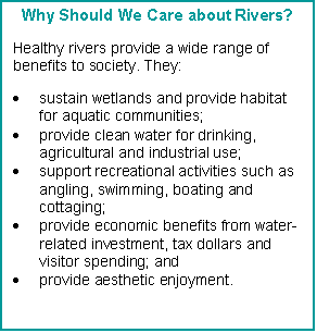
Executive Summary
The City of Ottawa is blessed with an extensive
network of rivers and streams. These provide many benefits. They provide us
with water for farms, industries, institutions and homes. They recharge
groundwater and support complex communities of wildlife. They provide beauty,
unparalleled vistas and a host of recreational opportunities for residents and
visitors alike.
Water Quality in Ottawa’s Rivers and Streams
was prepared by the City of Ottawa’s Water Environment Protection Program
(WEPP) to provide up-to-date information on the condition of Ottawa’s surface
water resources. It describes the City’s network of rivers and streams and
WEPP’s role in maintaining them in a healthy state. It outlines the City’s
ongoing Program to monitor water quality -- the Baseline Water Quality
Monitoring Program – and explains why we monitor, what we monitor and how we do
it. The document presents key findings from seven years of extensive water
quality monitoring representing some 6,000 samples taken from 6 rivers, 29
creeks, and 3 lakes. The report focuses on four key pollutants – phosphorus, E.
coli bacteria, copper and zinc.
The WEPP also carries out a Biological Assessment
Program that looks at the biological health of our surface waters. In this
Program, our staff identify the number of fish species present in Ottawa’s
streams and rivers, monitor their health and determine the levels of
contaminants present. Staff also look at other factors that are critical to the
health of aquatic communities such as stream temperature, the diversity of
benthic invertebrates (bottom-dwelling aquatic insects) and the levels of
dissolved oxygen, suspended solids, phosphorus and key metals in surface
waters.
The Baseline Water Quality Monitoring Program,
complemented by the Biological Assessment Program, has given valuable insight
into the current water quality in Ottawa’s rivers and streams. The major
conclusions drawn from the analysis of the monitoring data include the
following:
u
Water quality in the City’s major rivers is generally
good to excellent. This is good news for City residents in general and for
swimmers, boaters and anglers in particular.
u
Water quality tends to degrade as tributaries get
smaller. This reflects the lesser ability of small streams to tolerate
pollution. Since these ultimately impact all receiving water, we need to
remember that it is important to protect water quality in the smallest of
streams if we want to continue to enjoy good water quality in our rivers.
u
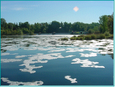
Phosphorus levels are a concern City-wide except for
in the main channels of the Ottawa and Mississippi Rivers. This reflects the
large number of point and non-point sources of this universal pollutant. We
need to continue to tackle the phosphorus issue in order to keep our
watercourses aesthetically pleasing, free of algae blooms and healthy for fish.
u
With the exception of a few localized areas, E.
coli levels, on average, are not a concern in the major rivers for body
contact recreation. Average concentrations in urban creeks exceed Federal and
Provincial water quality targets. The majority of rural creeks meet the
targets.
Metals (especially copper)
tend to be a concern in smaller tributaries in urban areas, reflecting the
inputs from roads, parking lots, and other potential pollution sources. With
few exceptions, the smaller tributaries in rural areas meet Federal and
Provincial targets.
u
Surrounding land uses can have significant impacts on
water quality. While many people link poor water quality to urbanization, our
data show that poor water quality can be found in both urban and rural streams.
u
Nine areas of concern were identified during the
analysis of the data, mostly on particular small tributaries.
Detailed, ongoing monitoring is necessary to
understand interactions between the environment and the waterways. This is the first step in improving and
protecting their health. The City’s Water Environment Protection Program has
had a number of notable successes in terms of protecting and enhancing the
health of our rivers and streams. To build on these successes, WEPP plans to:
u
continue the Baseline Monitoring Program across the
City to provide an ongoing assessment of the health of the aquatic environment
and identify areas of concern for further investigation or rehabilitation;
u
investigate expanding the Baseline Monitoring Program
to assess the bioaccumulation of toxins such as heavy metals, to provide early
identification of waterways that are subject to this type of pollution;
u
enhance the water quality monitoring programs
currently in place to provide information on existing pollution sources in
order that they may be targeted for elimination;
u
assess the impact of new developments, rehabilitative
measures and changes to open spaces on our waterways so that the information
can be used for better watershed management and decision making;
u
continue supporting the Public Health Branch in the
investigation and elimination of sources of contamination in an effort to
minimize the number of beach closures;
u
use existing stream assessment data to provide the
foundation for determining a stream rehabilitation strategy for all City
watersheds;
u
report regularly on water quality results and
continue to make data available on request to external agencies, organizations
and individuals;
u
investigate the use of Web-based applications to make
water quality information such as beach survey results and fisheries
assessments more accessible to the public; and
u
continue working with water quality partners to
protect fish habitat and the fisheries community.
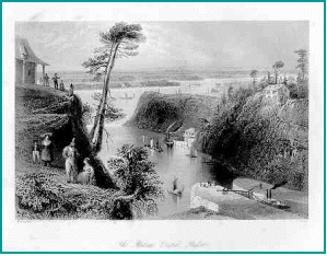 The
history of the City of Ottawa is inextricably linked to its rivers. The first
inhabitants of the area, the aboriginal people, used the Ottawa River as a
transportation route. The first European explorer, Samuel de Champlain paddled
up the Ottawa River in 1611 to explore the vast interior of New France and
opened the door to all those who followed. In his wake came other explorers,
adventurers, fur traders, and later the loggers who sent vast rafts of logs
down the river to the mills of Bytown and the ships of Montreal. The settlement
of Bytown (now Ottawa) was established at the place where the Rideau and Ottawa
Rivers meet. The building of the Rideau Canal between 1826 and 1832 – an
extraordinary feat of construction for its time -- was a defining event in the
City’s history.
The
history of the City of Ottawa is inextricably linked to its rivers. The first
inhabitants of the area, the aboriginal people, used the Ottawa River as a
transportation route. The first European explorer, Samuel de Champlain paddled
up the Ottawa River in 1611 to explore the vast interior of New France and
opened the door to all those who followed. In his wake came other explorers,
adventurers, fur traders, and later the loggers who sent vast rafts of logs
down the river to the mills of Bytown and the ships of Montreal. The settlement
of Bytown (now Ottawa) was established at the place where the Rideau and Ottawa
Rivers meet. The building of the Rideau Canal between 1826 and 1832 – an
extraordinary feat of construction for its time -- was a defining event in the
City’s history.
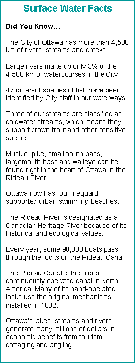
The Ottawa of today is still very much influenced by
the rivers and streams that run through it. The City is blessed with an
extensive network of watercourses that includes the Mississippi, South Nation,
Rideau and Ottawa Rivers and their tributaries. These watercourses -- all 4,500
km of them -- are invaluable and irreplaceable resources. Like the arteries and
veins in our bodies, they sustain life in the City. They provide us with water
for farms, industries, institutions and homes. They recharge groundwater and
support complex communities of wildlife. They provide beauty, unparalleled
vistas and a host of recreational opportunities for residents and visitors
alike.
The City’s Goal of Clean Water
 A healthy environment is vital for
quality of life and the long term sustainability of communities. The new City
of Ottawa Growth Management Plan (Ottawa 20/20) recognizes and endorses this
idea. One of Ottawa 20/20’s seven guiding principles is “A Green and
Environmentally Sensitive City” and one of the goals under this principle is
the goal of clean water. In the City’s Environmental Strategy this goal is
defined as:
A healthy environment is vital for
quality of life and the long term sustainability of communities. The new City
of Ottawa Growth Management Plan (Ottawa 20/20) recognizes and endorses this
idea. One of Ottawa 20/20’s seven guiding principles is “A Green and
Environmentally Sensitive City” and one of the goals under this principle is
the goal of clean water. In the City’s Environmental Strategy this goal is
defined as:
·
drinking water that is safe to consume;
·
healthy groundwater aquifers; and
·
rivers, creeks and lakes that support healthy aquatic
environments.
The Water Environment Protection Program is one of
the key internal departments charged with helping to achieve the City’s goal of
clean water. This document explains how
we do this.
 About this Document
This document has been prepared by the City of Ottawa’s
Water Environment Protection Program (WEPP) to provide up-to-date information
on the condition of Ottawa’s surface water resources. It describes the City’s
network of rivers and streams and WEPP’s role in maintaining them in a healthy
state. It also outlines the City’s ongoing program to monitor water quality --
the Baseline Water Quality Monitoring Program – and explains why we monitor,
what we monitor and how we do it. The document presents key findings from seven
years of extensive water quality monitoring representing some 6,000 samples
taken from 3 rivers and 29 creeks. From these results, we draw conclusions
about the health of our rivers and streams, and we identify key issues and
problem areas that need to be addressed. The document’s Appendix provides links
to additional resources for those interested in getting more information on
water quality or helping to protect our rivers and streams. We invite you to
join us on a tour of Ottawa’s rivers and streams!

|
|
THE
WATER ENVIRONMENT PROTECTION PROGRAM
|
|
 Who Are We?
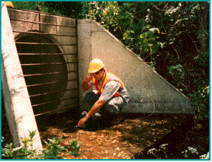
The Water Environment Protection Program was
established in 1992 by the former Regional Municipality of Ottawa-Carleton to
protect Ottawa’s streams and rivers and to ensure that they remain healthy for
future generations. It does this by assessing the state of the City’s surface
waters and coordinating actions to protect and improve their health. WEPP
carries out comprehensive water quality monitoring and tracks changes in water
quality over time. When sources of pollution are identified, City staff
initiate corrective action and coordinate action plans with conservation
authorities and Provincial and Federal agencies.
A key component of WEPP’s work is our Baseline Water
Quality Monitoring Program that provides ongoing information on the condition
of surface waters. The Program tracks water quality in 3 rivers and 29 creeks.
The information gathered in the Program is used in three ways. It provides
reference information that is used for ongoing municipal planning and design
purposes; it is also used to track water quality changes over time, identify
pollution threats and water quality problems; and it is used to evaluate the
success of rehabilitation or restoration efforts to make sure resources are
used wisely. This document reports on the results of water quality monitoring for
the seven years between 1998 and 2004. More detailed information on the
Baseline Water Quality Monitoring Program can be obtained from WEPP staff.
 The
WEPP also carries out a Biological Assessment Program that looks at the
biological health of our surface waters. In this Program, our staff identify
the number of fish species present in Ottawa’s streams and rivers, monitor
their health and determine the levels of contaminants present. Staff also look
at other factors that are critical to the health of aquatic communities such as
stream temperature, the diversity of benthic invertebrates (bottom-dwelling
aquatic insects) and the levels of dissolved oxygen, suspended solids,
phosphorus and key metals in surface waters.
The
WEPP also carries out a Biological Assessment Program that looks at the
biological health of our surface waters. In this Program, our staff identify
the number of fish species present in Ottawa’s streams and rivers, monitor
their health and determine the levels of contaminants present. Staff also look
at other factors that are critical to the health of aquatic communities such as
stream temperature, the diversity of benthic invertebrates (bottom-dwelling
aquatic insects) and the levels of dissolved oxygen, suspended solids,
phosphorus and key metals in surface waters.
The WEPP is also involved in long term planning
through the development of subwatershed studies, such as those done for the
Carp River, Shields Creek, Jock River Reaches 1 and 2 and Mud Creek. Subwatershed studies are developed to
protect, enhance and restore natural resources in a subwatershed over time.
 Why Do We Monitor?
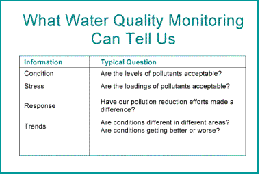
Water quality monitoring is important for many
reasons. It can help answer questions about the condition of a body of
water (i.e., the levels of pollutants). It can also tell us about the stresses
on water (the loadings of pollutants) and our responses (the
effectiveness of our protection, mitigation and restoration programs). The data
collected over time in monitoring program locations can shed light on trends,
relating both to space and time. Baseline information – such as that reported
on here -- can also be used as a yardstick against which the condition of other
water bodies can be measured.
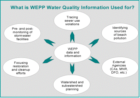
Water quality is both a fundamental component of a
healthy natural environment and an indicator of health. Understanding the health of our rivers and
streams is a vital part of taking action to protect the natural environment.
The water quality data and information collected by the WEPP is used by
internal City departments to focus investigations, inform planning, and guide restoration
and remediation efforts where it is most needed. It is also used by external
agencies, such as the Ministry of Natural Resources (MNR), the Department of
Fisheries and Oceans (DFO) and the three Conservation Authorities in the area.
The data and information collected by the WEPP augments that collected by the
Conservation Authorities, which is collected for different reasons and at a
different scale (watershed-wide rather than City-wide).
Good information is the cornerstone of good planning.
Having a databank of good water quality information allows WEPP to apply
“adaptive management” strategies for Ottawa’s rivers and streams. In simple
terms, this means that through monitoring we can identify water quality
problems, and then develop strategies to address them. Ongoing monitoring
allows us to see if our efforts have been successful, and then adjust or adapt
them if necessary to achieve our objectives.
What Have We Achieved?
The City’s Water Environment Protection Program has contributed greatly
to the protection and enhancement of water quality in our rivers and streams.
Information collected has been used to eliminate pollution sources and to help guide environmentally friendly development. Some of our
“success stories” include:
·
pinpointing and repairing hundreds of cross-connected sewers;
·
identifying and mitigating a wide range of pollution sources including
illegal sewer connections and industrial discharges;
·
identifying gulls as a source of contamination, resulting in the
installation of gull wires at Britannia and Mooney’s Bay beaches, reducing
pollution from birds, improving water quality and reducing beach closures;
·
in partnership with Parks Canada, changing how the levels in the Rideau
River are altered to reduce impacts on fish communities; and
·
monitoring stormwater management facilities after improvements are made
to ensure that water quality is protected.
SPOTLIGHT ON THE BASELINE WATER
QUALITY PROGRAM
|
|
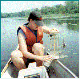
How We Measure Water Quality
 In the City’s Baseline Water
Quality Monitoring Program, water samples are evaluated against three sets of
criteria – the Provincial Water Quality Objectives (PWQO), the Canadian Water
Quality Guidelines (CWQG) for the Protection of Aquatic Life, and the Canadian
Council of Ministers of the Environment (CCME) Water Quality Index. The
Provincial objectives and Federal guidelines are set at levels that protect all
forms of aquatic life and protect recreational uses based on public health and
aesthetic considerations. The CCME Water Quality Index is a useful
communications tool that translates complex water
quality data into simple terms (e.g., excellent, good, poor) for reporting.
Like the Provincial Air Quality Index, the Water Quality Index gives
information on overall water quality without being specific.
In the City’s Baseline Water
Quality Monitoring Program, water samples are evaluated against three sets of
criteria – the Provincial Water Quality Objectives (PWQO), the Canadian Water
Quality Guidelines (CWQG) for the Protection of Aquatic Life, and the Canadian
Council of Ministers of the Environment (CCME) Water Quality Index. The
Provincial objectives and Federal guidelines are set at levels that protect all
forms of aquatic life and protect recreational uses based on public health and
aesthetic considerations. The CCME Water Quality Index is a useful
communications tool that translates complex water
quality data into simple terms (e.g., excellent, good, poor) for reporting.
Like the Provincial Air Quality Index, the Water Quality Index gives
information on overall water quality without being specific.
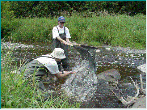
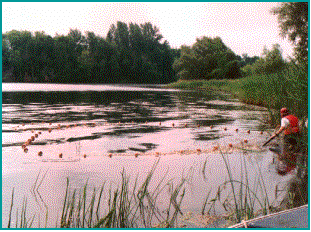
How We Monitor Water Quality
The City’s Baseline Surface Water Quality Monitoring
Program is designed to monitor water quality across the City and identify long
term trends. The Program uses 91 sampling points that are sited to give
coverage of the major rivers, major tributaries and smaller tributaries.
Sampling is done monthly at each monitoring site unless conditions (such as ice
cover) prohibit it. From 1998 to 2004, each monitoring site was sampled between
56 and 84 times.
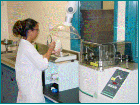
Each sample is analysed for 43 different parameters
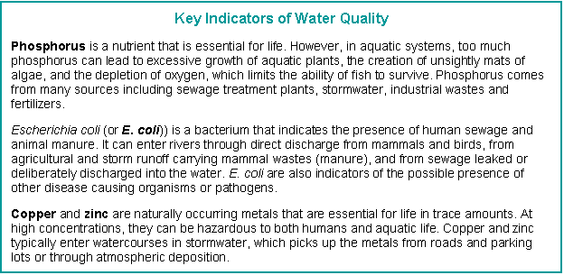
or water quality attributes. The results for four key pollutants of concern –
phosphorus, E. coli, copper and zinc – are provided in this report.


INTRODUCING
OTTAWA’S RIVERS AND STREAMS
|
|
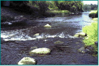
Major Rivers
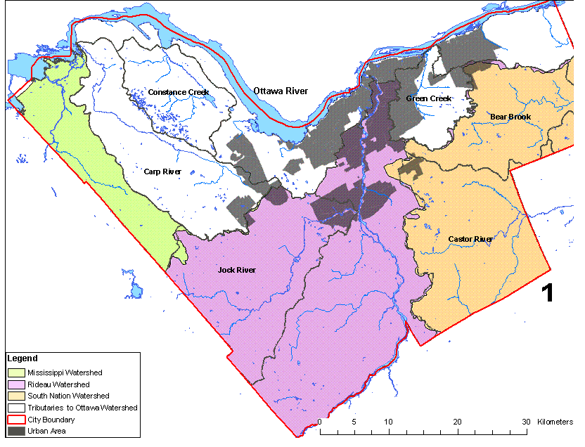
Within its boundaries, the City of Ottawa has
portions of four watersheds – the Ottawa, the Mississippi, the Rideau and the
South Nation -- see Figure 1. Each of these watersheds has a distinct identity
that is shaped by geology and land use. While these large rivers are highly
visible and fairly well known, it is interesting to note that they make up only
3% of the 4,500 km of streams and rivers in the City. This underscores the
importance of the 97% of stream length that is made up of a few large
tributaries and hundreds of small streams.
Land
Use in the Major Watersheds Within the City Limits
|
Watershed
|
Total Area
(km2)
|
Forest
%
|
Urban
%
|
Agriculture
%
|
Water
%
|
% within Ottawa
|
|
Ottawa
|
146,222
|
75
|
<1
|
10
|
13
|
2
|
|
Mississippi
|
4,059
|
70
|
<1
|
15
|
15
|
4
|
|
Rideau
|
3,935
|
44
|
4.5
|
38
|
16
|
23
|
|
South Nation
|
4,184
|
35
|
1
|
62
|
2
|
15
|
 Ottawa River
The Ottawa River is over 1,200 km in length and
drains a huge area (over 140,000 km2). Only 2% of the river lies
within the City’s boundaries. From its source in Lake Capimitchigama in western
Quebec, the Ottawa River flows to Lake Temiskaming and then southeast to empty
into the St. Lawrence River at Montreal. The characteristics of the Ottawa
River reflect the landscape through which it flows, which is dominated by the
forested Canadian Shield, relatively little agricultural land use and less than
1% urbanization. This leads to river water that is generally of good quality,
but which is relatively sensitive to pollutants.
 Mississippi River
The Mississippi River is about 160 km in length and
drains an area of 4,059 km2. Only 4% of the
river lies within the City’s boundaries. The source of the Mississippi is east
of the Kawartha Lakes. From there it flows northeast to empty into the Ottawa
River just east of Arnprior. Upstream of the City’s boundaries the Mississippi
flows through a typical Canadian Shield landscape dominated by forests. There
is relatively little agricultural land use in the watershed and only 1%
urbanization. Similar to the Ottawa River, the water quality in the Mississippi
is generally of good quality, and is relatively sensitive to pollutants.
 Rideau River
The Rideau River is 146 km in length and drains an
area of 3,935 km2. About 23% of the
watershed lies within the City boundaries. It originates in Upper Rideau Lake
and empties into the Ottawa River at Rideau Falls. The Rideau River is distinctly
different from Ottawa’s other large rivers, in that its water levels are
regulated from May to October so that the canal can provide deep enough water
for boat passage. During the navigation season, upstream of the Hog’s Back
lock, this means that the river has more of the characteristics of a shallow
reservoir than a river. Downstream of the Hog’s Back lock, where the canal is
separate from the river, the Rideau reclaims its free-flowing identity. The
upper third of the Rideau River watershed flows through the granite of the
Canadian Shield, while the lower two-thirds flows through limestone. This
geology affects water quality in the river, as does the land use, which is more
urbanized and has more agriculture than either the Ottawa or the Mississippi
Rivers.
 South Nation River
The South Nation River is 175 km in length and drains
an area of 4,184 km2. About 15% of the watershed lies within the
City boundaries. From its headwaters north of Brockville, the South Nation
River flows northeast and empties into the Ottawa River near Plantagenet. Water
quality in the South Nation is influenced by the limestone geology through
which it flows and the dominance of agricultural land use (62% of the
watershed). The main branch of the South Nation River does not flow through the
City of Ottawa, so for water quality monitoring purposes, it is addressed under
its major tributaries (the Castor River and Bear Brook), which are introduced
in the next section.
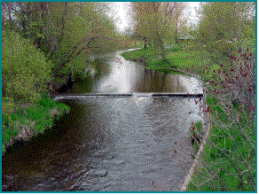
Major Tributaries
The City’s “major tributaries” are the smaller rivers
and large streams that drain areas greater than 300 km2 in size and
which empty into one of our major rivers. There are four of these within the
City of Ottawa and their location is shown in Figure 1. These are:
·
the Carp River, the only major tributary that is
wholly contained within the City of Ottawa, which drains directly into the
Ottawa River;
·
the Jock River, which drains into the Rideau River;
·
the Castor River, which drains into the South Nation
River; and
·
Bear Brook Creek, which drains into the South Nation
River.
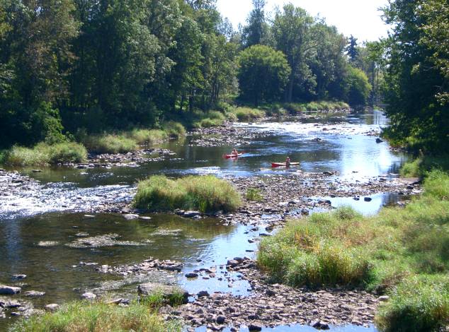
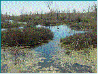
Smaller Tributaries

 The City of Ottawa contains
hundreds of smaller tributaries including streams, brooks and intermittent
watercourses. While these may seem to be less valuable than large rivers and
major tributaries, they are fundamentally important to ecological health and in
many cases are irreplaceable. These small tributaries provide drainage and
vital aquatic habitat for a wide variety of aquatic organisms. Because of their
size, however, small tributaries are more sensitive to pollution than larger
watercourses.
The City of Ottawa contains
hundreds of smaller tributaries including streams, brooks and intermittent
watercourses. While these may seem to be less valuable than large rivers and
major tributaries, they are fundamentally important to ecological health and in
many cases are irreplaceable. These small tributaries provide drainage and
vital aquatic habitat for a wide variety of aquatic organisms. Because of their
size, however, small tributaries are more sensitive to pollution than larger
watercourses.
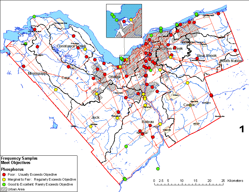
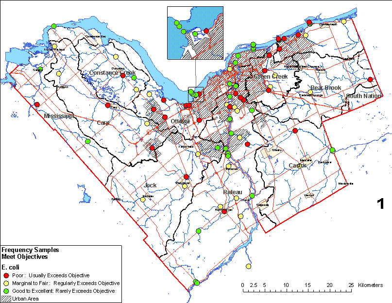
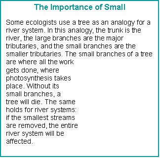
The monitoring results for the seven years between
1998 and 2004 have been summarized below with respect to the percentage of
samples that meet the Provincial and Federal water quality targets. It should
be noted that this is an overall assessment.
There are some exceptions to the overall assessment, for example, rural
creeks where water quality is very good. The water quality results at each of
the monitoring stations are mapped on Figure 2 (for phosphorus) and
Figure 3 (for E. coli).
Rating
System and Colour Coding
|
Rating
|
% Samples Meeting
Water Quality Targets
|
What it Means
|
|
Excellent
|
95 to 100
|
Rarely failed to meet targets
|
|
Good
|
80 to 94
|
|
|
Fair
|
65 to 79
|
Exceeded targets occasionally
|
|
Marginal
|
45 to 64
|
|
|
Poor
|
0 to 44
|
Exceeded targets often or significantly
|
Major Rivers
Water quality in the Ottawa, Mississippi and Rideau
Rivers is generally good to excellent. This is largely due to the relatively
low proportion of urban development and agriculture in their watersheds.
The exception to the overall “good to excellent”
assessment of the City’s major rivers is the levels of phosphorus in the Rideau
River, which is marginal. Only about 45% of samples taken from the Rideau met
water quality targets for phosphorus. (By comparison, 100% of samples from the
Ottawa and 86% of samples from the Mississippi met the water quality targets
for phosphorus).
|
Major River
|
|
E. coli
|
Copper
|
Zinc
|
|
Ottawa River
|
Excellent
|
Good
|
Good
|
Excellent
|
|
Mississippi River
|
Good
|
Good
|
Excellent
|
Excellent
|
|
Rideau River
|
Marginal
|
Good
|
Good
|
Excellent
|
Major Tributaries
Water quality in the City’s major tributaries varies
from poor to excellent, depending on the pollutant. Levels of metals are good to excellent, although copper is rated
as marginal for Bear Brook. E. coli levels are fair in the Jock River
and marginal in the other major tributaries. Phosphorus levels are marginal in
the Jock River and poor for the other three major tributaries. Of the four
major tributaries, Bear Brook has the poorest rating for all four pollutants.
|
Major Tributary
|
|
E. coli
|
Copper
|
Zinc
|
|
Carp River
|
Poor
|
Marginal
|
Good
|
Excellent
|
|
Jock River
|
Marginal
|
Fair
|
Good
|
Excellent
|
|
Bear Brook
|
Poor
|
Marginal
|
Marginal
|
Good
|
|
Castor River
|
Poor
|
Marginal
|
Good
|
Excellent
|
Smaller Tributaries
Water quality in the City’s smaller tributaries
varies from poor to excellent, depending on the pollutant. Phosphorus levels
are rated as poor in both rural and urban areas, and E. coli levels are
poor in urban creeks and marginal in rural creeks. In terms of the frequency of
meeting water quality targets, urban creeks are worse than rural creeks. The
higher levels of metals in urban creeks reflect the influence of urban runoff
from roads and parking lots.
|
Small Tributary
|
|
E. coli
|
Copper
|
Zinc
|
|
Urban Creeks
|
Poor
|
Poor
|
Fair
|
Good
|
|
Rural Creeks
|
Poor
|
Marginal
|
Good
|
Excellent
|
Areas of Concern
|
Dominant
Upstream
Land Use
|
Area of
Concern
|
|
Urban
|
Bilberry
Creek
Green
Creek at Montreal Road
Green
Creek at Innes
|
|
Rural
|
Bear
Brook at Boundary Road/RR#4
Becketts
Creek
Cardinal
Creek
Flowing
Creek at Richmond
|
|
Mixed
|
Casey
Creek at Dunrobin Road
Green
Creek downstream of Ramsay Creek
|
Nine areas of concern were identified during the
analysis of the data. These areas are monitoring stations on particular small
tributaries in which high levels of phosphorus, E. coli and metals were
found. Some of these tributaries drain urban areas, some drain rural areas, and
some drain areas with mixed land use.
Trends Noted
With the exception of the main channels of the Ottawa
and Mississippi Rivers, phosphorus is a concern in all the City’s rivers and
streams. In all watercourses other than the Ottawa and Mississippi Rivers,
phosphorus levels are rated as poor or marginal and average concentrations
exceed water quality targets.
E. coli is not a concern in the major
rivers. The Rideau River has the lowest average E. coli concentration of
all the watercourses sampled. The highest average concentrations of E. coli are
found in Bear Brook and in the urban creeks.
In general, average concentrations of metals are not
a concern. The exception to this is the average concentration of copper in Bear
Brook, which exceed water quality targets. The highest average concentration of
zinc is seen in urban creeks. As noted above, this reflects the extent of urban
runoff from roads and parking lots.
Overall, water quality tends to decline as the size
of waterbodies decreases.
Increasing levels of phosphorus and E. coli are
seen on the Ottawa River downstream of the urban area. This is due to the
influence of the Rideau and Gatineau Rivers, stormwater from the City of
Ottawa, and the wastewater treatment plants that serve Ottawa and Gatineau.
Increasing levels of E. coli are seen in the
Rideau River with distance downstream. However, the variability of levels
suggests the influence of local sources rather than a cumulative effect. A
significant increase in phosphorus levels is noted when the river reaches the
Black Rapids. This is likely the influence of some rural tributaries, which
empty into the Rideau upstream from the Black Rapids.
Increased levels of phosphorus and zinc are seen in
the City’s tributaries during the spring melt, when runoff picks up pollutants
from farms, yards, roads and parking lots.
A key question with monitoring is whether water
quality conditions are getting better over time or worse. Statistically, trends through time would not
generally expect to be clearly evident until approximately ten years of data
are available. Therefore, continued
monitoring is advisable in order to verify the trends that have emerged to date
and note those that may not yet have become apparent.


The Baseline Water Quality Monitoring Program,
complemented by the Biological Assessment Program, has given us valuable
insight into the water quality of Ottawa’s rivers and streams. The major
conclusions drawn from the analysis of the monitoring results are presented
below.
u
Water quality in the City’s major rivers is generally
good to excellent. This is good news for City residents in general and for
swimmers, boaters and anglers in particular.
u
Water quality tends to degrade as tributaries get
smaller. This reflects the lesser ability of small streams to tolerate
pollution. Since these ultimately impact all receiving water, we need to
remember that it is important to protect water quality in the smallest of
streams if we want to continue to enjoy good water quality in our rivers.
u
Phosphorus levels are a concern City-wide except for
in the main channels of the Ottawa and Mississippi Rivers. This reflects the
large number of point and non-point sources of this universal pollutant. We
need to continue to tackle this pollutant in order to keep our watercourses
aesthetically pleasing, free of algae blooms and healthy for fish.
u
With the exception of a few localized areas, E.
coli levels, on average, are not a concern in the major rivers for body
contact recreation. Average concentrations in urban creeks exceed Federal and
Provincial water quality targets. The majority of rural creeks meet the
targets.
u
Metals (especially copper) tend to be a concern in
smaller tributaries in urban areas, reflecting the inputs from roads, parking
lots, and other potential pollution sources. With few exceptions, the smaller
tributaries in rural areas meet Federal and Provincial targets.
u
Surrounding land uses can have significant impacts on
water quality. While many people link poor water quality to urbanization, our
data shows that poor water quality can be found in both urban and rural
streams, usually for different reasons.
Detailed, ongoing monitoring is necessary to
understand interactions between the environment and the waterways. This is the first step in improving and
protecting their health. The City’s Water Environment Protection Program has
had a number of notable successes in terms of protecting and enhancing the
health of our rivers and streams. To build on these successes, WEPP plans to:
u
continue the Baseline Water Quality Monitoring
Program across the City to provide an ongoing assessment of the health of the
aquatic environment and identify areas of concern for further investigation or
rehabilitation;
u
investigate expanding the Baseline Monitoring Program
to assess the bioaccumulation of toxins such as heavy metals, to provide early
identification of waterways that are subject to this type of pollution;
u
enhance the water quality monitoring programs
currently in place to provide information on existing pollution sources and
initiate corrective actions for their elimination;
u
assess the impact of new developments, rehabilitative
measures and changes to open spaces on our waterways so that the information
can be used for better watershed management and decision making;
u
continue supporting the Public Health Branch in the
investigation and elimination of sources of contamination in an effort to
minimize the number of beach closures;
u
use existing stream assessment data to provide the
foundation for determining a stream rehabilitation strategy for all City watersheds;
u
report regularly on water quality results and
continue to make data available on request to external agencies, organizations
and individuals;
u
investigate the use of Web-based applications to make
water quality information such as beach survey results and fisheries
assessments more accessible to the public; and
u
continue working with water quality partners to
protect fish habitat and the fisheries community.
There are many Web-based sources of information on
the health of Ottawa’s surface water resources and programs that contribute to
reducing pollution. Some are listed below, along with links for people who are
interested in helping to improve the health of our lakes, streams and rivers.
Getting Information
¨
LandOwner Resource Centre: The
LRC was established by the Rideau Valley Conservation Authority in 1993 to
provide “one stop shopping” for rural landowners. The Centre, located in
Manotick, provides information on issues relating to woodlot management,
insects and pests, water, wildlife and conservation of wetlands. For more
information, see http://www.lrconline.com/index.htm
¨
Water Efficiency: Conserving water is good for the environment
because it reduces the impact on water resources and
reduces the energy required to treat and transport the water. It is also good
for the economy because it is cheaper to conserve water than it is to build new
treatment capacity. The City of Ottawa’s Web site has information on how
residents can become more water efficient, both inside and outside the house.
For more information, see
http://ottawa.ca/City_services/water/efficiency/index_en.shtml
¨
Rideau Valley Conservation Authority: The RVCA
Web site provides data and information on the characteristics of the Rideau
watershed and RVCA’s programs, publications and news. For more information, see
http://www.rideauvalley.on.ca/
¨
Mississippi Valley Conservation Authority:
The MVCA’s Web site provides information on water management, water planning
and regulations, and conservation education programs. For more information, see
http://www.mvc.on.ca/index.html
¨
South Nation Conservation: The
SNC Web site provides information on the history of the South Nation watershed,
SNC’s programs and services, recreational resources and news and events. For
more information, see http://www.nation.on.ca/English/index.htm
¨
The Nature of the Rideau River: This Web site was established by the
Canadian Museum of Nature. It provides information on the history and geography
of the river, along with information on water quality and biodiversity. The
Rideau River Biodiversity Project, carried out by the CMN and the former
Regional Municipality of Ottawa-Carleton, identified the number of species of
aquatic plants, aquatic birds, fish, mussels, invertebrates, amphibians and reptiles
in various parts of the Rideau River. For more information, see
http://www.nature.ca/rideau/index-e.html

Getting Involved
¨
City Stream Watch: This is a
partnership involving the Rideau Valley Conservation Authority, the City of
Ottawa, and four other partners. The Program trains volunteers to monitor local
streams for water temperature, fish habitat potential and other
characteristics. Founded in 2003, the program now includes stream cleanup,
shoreline rehabilitation, shoreline plantings and fish habitat improvements.
For information, see http://www.rideauvalley.on.ca/programs/streamwatch/
¨
Friends of the Carp: Friends
of the Carp is a group of volunteers that are dedicated to improving the
quality of the Carp River. The group is focused on restoring shoreline
vegetation along the river for the benefit of both human and wildlife
communities. For more information, see http://www.friendsofthecarpriver.com/
¨
Rural Clean Water Program:
This Program was developed by the City of Ottawa in cooperation with local farm
and rural organizations and universities. Administered by the Conservation
Authorities, the Program offers grants and technical assistance for rural
projects to reduce pollution. These include improving manure storage, repairing
septic systems, establishing buffers, reducing soil erosion and improving
cropping practices. For more information, contact the Landowner Resource Centre
at http://www.lrconline.com/index.htm
¨
Friends of Jock River: The
Friends of the Jock River is a non-profit, charitable environmental
organization managed by volunteers in the Jock River watershed. Its mandate is
to protect the Jock River watershed ecosystem. For more information, see
http://www.geocities.com/jockriver/
¨
Ottawa Riverkeeper: Ottawa
Riverkeeper is a citizen-based organization that is aimed at achieving a
healthy, ecologically sustainable Ottawa River. The organization is open to all
individuals and groups with a commitment to and interest in the ecological
welfare of the Ottawa River. For more
information, see http://www.ottawariverkeeper.ca/main.php